1.1 Project Name
The collection of geographic information related to the experimental field of "Beijing Desertification and Desertification Monitoring and Sandstorm Emergency Monitoring".
1.2 Customer background and needs
A professor at Beijing First University is conducting a research project on “Beijing Desertification and Desertification Monitoring and Sandstorm Emergency Monitoringâ€. The project address is in Beijing and it is necessary to obtain relevant data of the experimental field through drones for research.
1.3 Flight mission analysis
The project requires an area of ​​6.63 square kilometers for flight mapping, and the flight area is approximately rectangular, and the aerial survey is based on the geographic coordinates of the rectangular four corners. The coordinates are as follows:
![[Nine-day drone] The application of maps for research projects in Beijing](http://i.bosscdn.com/blog/17/08/49/132085.jpg)
The topography of the working area is a combination of mountains and plains. It is dominated by mountains and supplemented by plains. The average altitude is about 200 meters, the highest altitude is about 665 meters, and the lowest altitude is about 284 meters.
1.4 Precision requirements
The image data obtained by this aerial survey is applied to the topographic map with a scale of 1:2000, and the orthophoto image (DOM) and digital HD model (DEM) of the surveying area are required to be output, so aerial survey is required. The ground resolution of the image data is less than or equal to 0.3 m, and the ground resolution used in this flight is 0.25 m or less.
1.5 Equipment selection
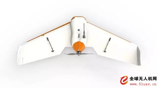
The nine-day drone uses the intelligent aerial survey system Tiankui type 1 for the aerial survey mission. The three-mode dual-frequency GPS positioning is used for navigation and positioning. In addition to the 1:2000 topographic map, high precision can be obtained. The DOM image has a ground resolution of 0.21~0.25m, which can meet the aerial survey results required by this customer.

2 program design
The area of ​​the operation survey area is 6.63km2, the terrain is mainly mountainous, the average altitude is about 200m, the highest is about 665m, and the lowest is about 284m. According to the data of the customer demand, the Tiankui type 1 fixed wing is adopted in the flight plan. The man-machine is equipped with a 18.2 megapixel super-optical stabilization lens to ensure that the camera obtains high-quality data images with sufficient light input. The ground resolution is 0.25m, the relative altitude is 900m, and the heading overlaps 80%. The side overlap is 80%, and one flight operation task is designed. The average flight height is about 874m. According to the highest point and the lowest point elevation of the survey area, the ground resolution of the actual acquired image is calculated to be 0.21~0.24m. Meet the requirements of the customer's 1:2000 aerial survey data.
In this operation, the post-processing differential method is used for GPS data processing, and the known points near the surveying area are selected to set up the base station. In order to ensure the accuracy of the data required by the customer, the flying drone GPS adopts a sampling frequency of ≥10 Hz. The ground station adopts a sampling frequency of ≥10 Hz, and both of them observe data acquisition at the same time to ensure the accuracy of data collection.
3 Flight parameters
In this flight, according to the customer's needs combined with the pre-output results, the Tiankui 1 UAV system equipped with an optical stabilization lens was used for aerial survey. The specific parameters are as follows:
![[Nine-day drone] The application of maps for research projects in Beijing](http://i.bosscdn.com/blog/17/10/06/912085.jpg)
During the flight test flight, the flight data monitored by the ground station was normal, the cruising speed was basically maintained at 50km/h, the flight attitude was stable, and the three-angle angle deviation was < 2°. A total of 54 original images were taken, which took about 12 minutes. And confirm that all the image data is qualified and available, and the aerial survey aircraft operation is successfully completed.
4 results output
Add the data obtained by the flight to the professional software processing, and output the following results according to the customer's needs:
![[Nine-day drone] The application of maps for research projects in Beijing](http://i.bosscdn.com/blog/17/10/33/692085.jpg)
Gin Pole of various types including Aluminum Alloy Grid Gin Pole,Tower Suspension Gin Pole,Tube Gin Pole,etc,which is specially used for erecting concrete pole or high voltage steel tower in power line transmission project.It is made of high strength steel or Alu alloy with reasonable volume,light weight,easy to operate.By high quality Alum or steel material and good design(each side has its own pulleys or fixed device),this kind of tower erecting gins can be durable and long service life.we are a professional Chinese exporter of Gin Pole,Gins,Pole Erector,Pole Erecting Tool and we are looking forward to your cooperation.
Yangzhou Qianyuan Electric Equipment Manufacturing & Trade Co. Ltd is specialized in manufacturing and trade of electric power line transmission tools. Our main products are Anti-twisting Steel Wire Rope,Stringing Pulley,Hydraulic Crimping Compressors,Engine Powered Winch,Motorised Winch,Wire Grip,Gin Pole,Cable Stand,Mesh Sock Grips,Cable Conveyor,Lever Chain Hoists and so on,which are mainly supplied to power companies,railroad companies and other industry fields.
All our products are certified by China National Institute.To assure the quality, we will do 100% inspection for raw material, production procedure, packing before shipment,
so we do have the confidence to supply customers with high-quality and high-efficiency products.
"Customer satisfaction" is our marketing purposes,so we have extensive experience in professional sales force,and strongly good pre-sale, after-sale service to clients. We can completely meet with customers' requirements and cooperate with each other perfectly to win the market.Sincerely welcome customers and friends throughout the world to our company,We strive hard to provide customer with high quality products and best service.
gin pole, aluminum gin pole, gin pole rigging, pole erector, tower erection
Yangzhou Qianyuan Electric Equipment Manufacturing & Trade Co.Ltd , https://www.qypowerline.com